
Story Of The Family


Vineyards

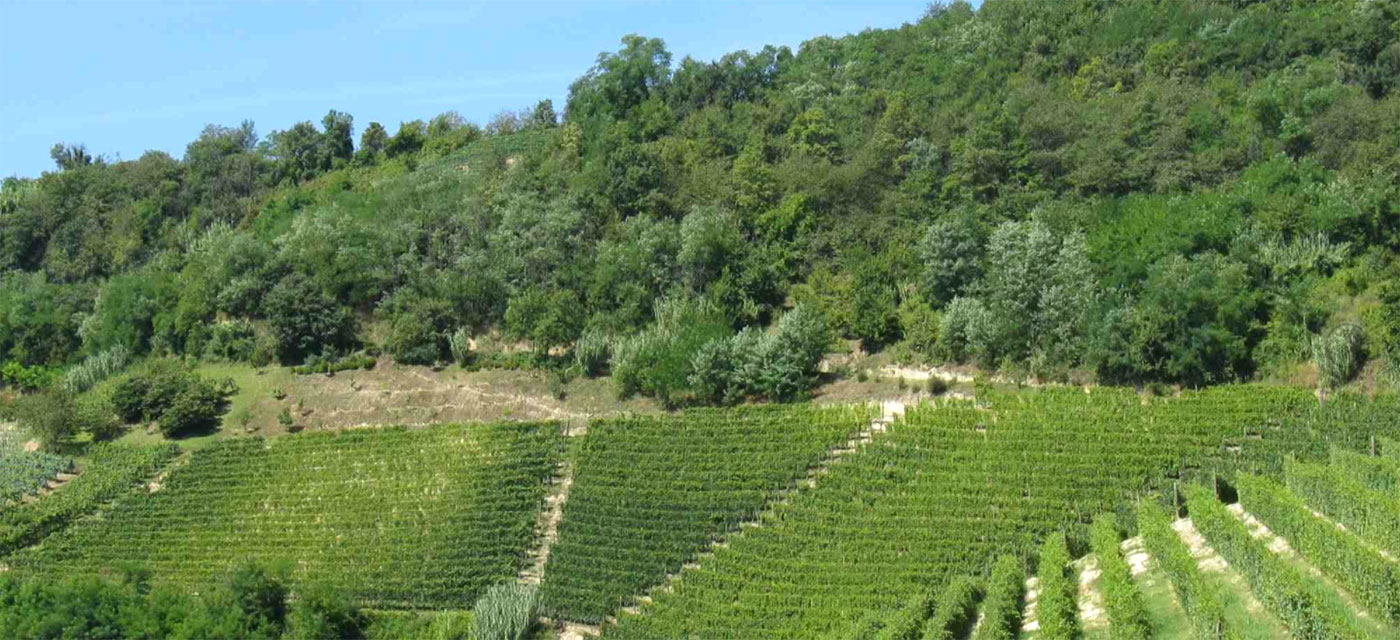
Vineyards in Barbaresco (about three hectares), at the foot of the Socré farm, constitute the center and heart of the company. They are placed in a splendid panoramic position, about a kilometer before the hamlet Tre Stelle of the village of Barbaresco, coming from Alba. The subarea mention of our estate is all named Roncaglie.
The position of the land is declivous, with slopes from medium to high; exposure is between south and west; altitude between 250 and 290 m a.s.l. .
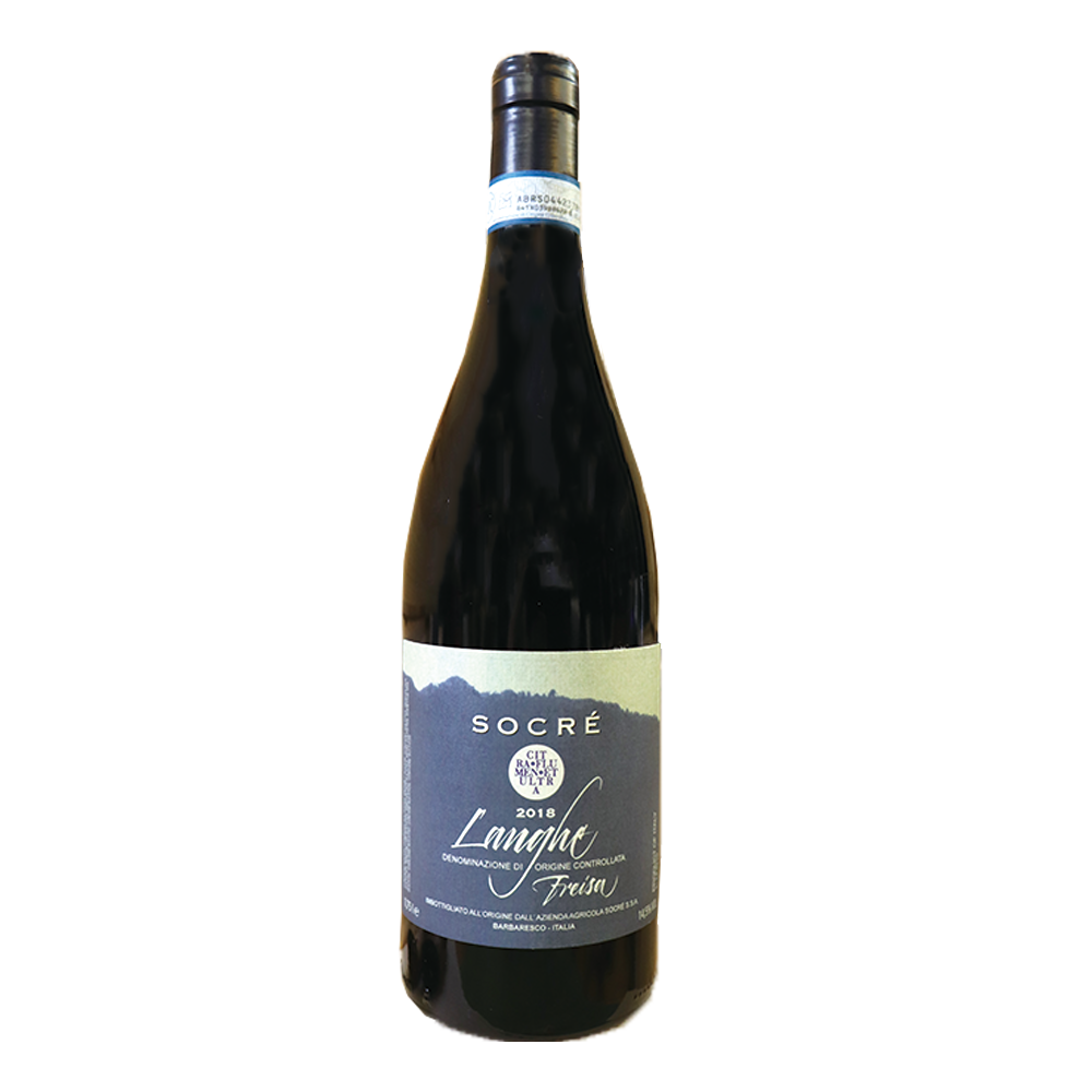
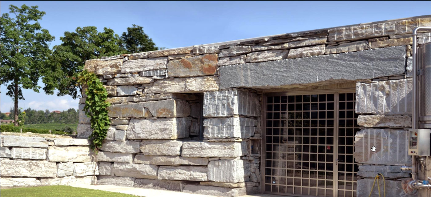
Here, in addition to our winery, we grow most of our wine grapes. Until the early twenty-first century, we kept also some Dolcetto and Barbera vineyards planted in the sixties and seventies. Following the reorganization of production in the company that took place in the twenty-first century, on this land we exclusively grow Nebbiolo.
THE VILLAGE
Barbaresco (CN) is located 4 km linear distance northeast of Alba (8 on the road) and 50 km southeast of Turin.
Altitude: 255 m a.s.l. at the village center. 270 at our farm.
Barbaresco is a relatively small municipality and it is characterized by scattered houses and tiny hamlets. Its landmark is its medieval tower. At main village center, where there is also the town hall, there is also the church of San Donato, now deconsecrated, which has been restored and adapted for regional wine. Below the beautiful frescoed vault, this former church now houses the exhibition of ethnographic material and stands of bottles.
GEOLOGICAL CONDITIONS
Soil composition is in majority clay, with a limestone base and a marked alkaline reaction. Stratified marl-clay and silt derived from an ancient seabed form the whole texture. This seabed was deposited by currents of finely murky waters, in an ocean of 50 million years ago. The sea bottom later raised and Quaternary alluvial deposits mixed into the scattered microzones that we find today.
In the steepest vineyards, in gray-blue tuff, stones of Langa outcrop. The characteristic gray-blue color is due to that original seabed, sedimented in the absence of oxygen. Stones of Langa, on the other hand, are traditionally used in local architecture.
Vineyard sub-areas of the town of Barbaresco, including ours, are:
Asili, Ca Grossa, Cars, Cavanna, Cole, Cortini, Faset, Martinenga, Montaribaldi, Montefico, Montestefano, Muncagota, Niccolini, Ovello, Paje, Pora, Rabaja, Rabaja-Bas, Rio Sordo, Roccalini, Roncaglie, Roncagliette, Ronchi, Secondine, Tre Stelle, Trifolera, Vicenziana.


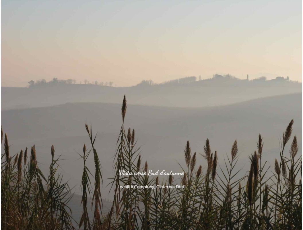
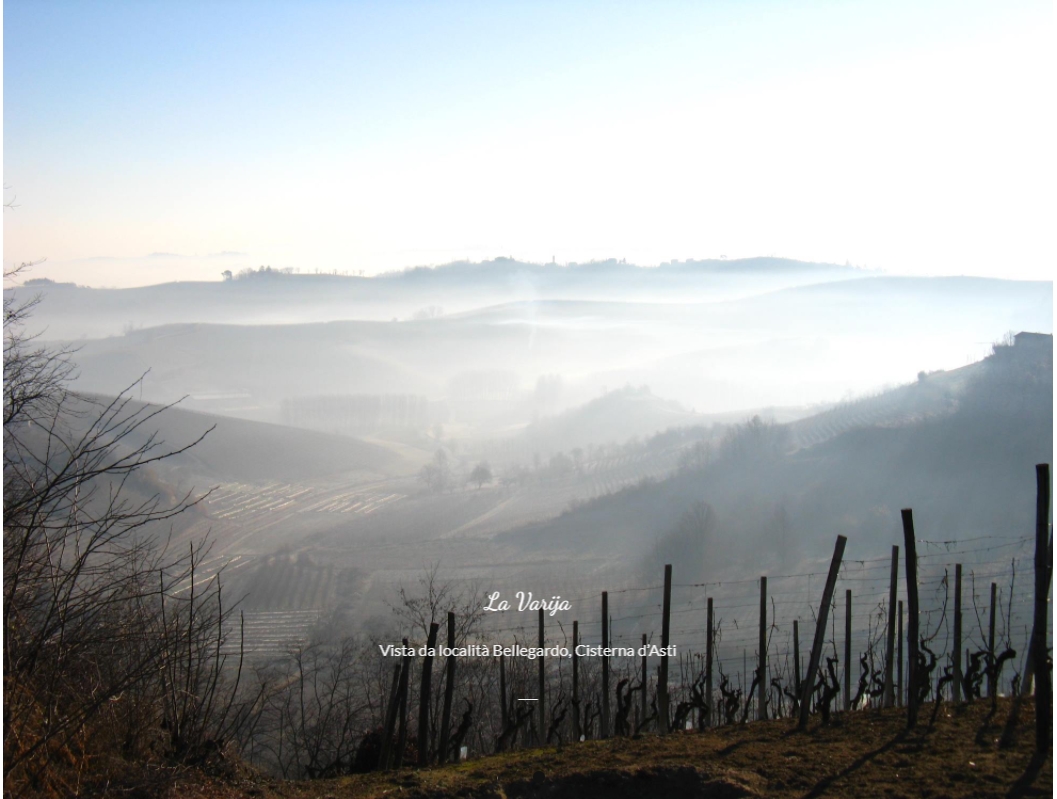
In Cisterna d’Asti (between Monferrato and Roero), next to traditional and tested Barbera, and Croatina we grow vineyards of cabernet sauvignon and merlot. The land in Cisterna d’Asti is very hilly, and the slopes are exposed to the south east at an altitude between 240 and 270 m above sea level; the texture of the soil is clayey-sandy on a mainly calcareous base. This is a total of about 2 hectares of land.
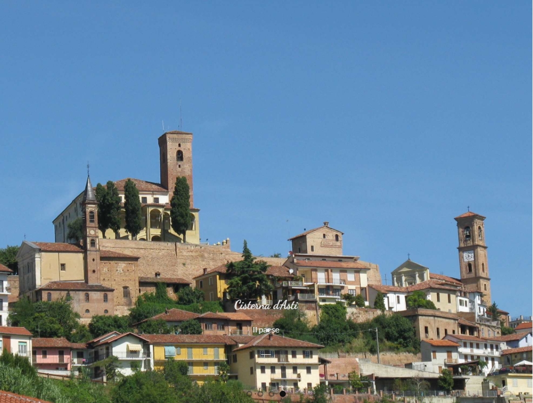
THE VILLAGE
The town of Cisterna d’Asti is characterized by the dominant silhouette of the castle, and it is a typical example of an hilltop village of ancient origin, once surrounded by walls and natural embankments (the castle and the “villa”). Agricultural boroughs grew outside of the town and the gates, gradually, along access roads.
DO NOT MISS IN CISTERNA
- Il Museo Arti e Mestieri di Cisterna
- Open Castles/Viaggio nelle terre del Basso Piemonte (Sundays in spring and autumn)
- Cisterna d’Asti wine fest (last Sunday of June)
- Mercandé (first Sunday of October, by Madonna del Rosario), with “Aleramic market”, tasting of local products.
GEOLOGICAL CONDITIONS
The hilly territory of Cisterna belongs morphologically and geologically to the area of Roero (Cuneo), which is localized in the Tertiary Basin of Liguria – Piedmont.
Compact sandy soils, that often shape the characteristics of “strongholds”, are related to the period Astian (Upper Pliocene marine deposits which are represented by sand and silt yellowish, moderately fossiliferous).
Since ancient times, the inhabitants of these places used to dig the most solid parts of the hills, at first in order to gain shelters and caves, then storage for food supplies, wine cellars and also wells. Even today, along the country roads, we can encounter big niches carved into this particular “tuff”, where the traveler was sheltered from the rain and farmers could store equipment.
In the town, the caves (“crotin”) are still used as cellars, and sometimes wind over long distances underground, also at different altitudes, until they reach other homes or places. These are arch-based tunnels, not higher than 2.5 m and a width of about 1.5 to 5 meters. Along the sides they can present small niches, hooves, benches or recesses to hold bottles.